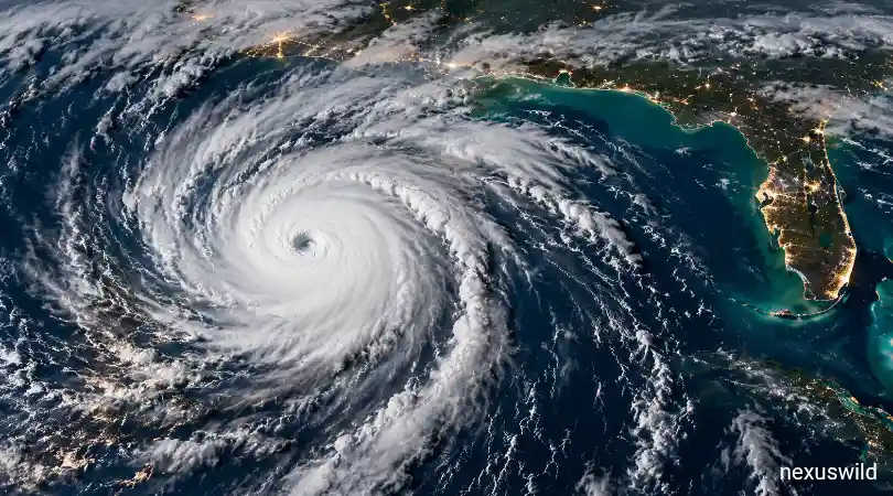

Hurricane Isaias has rapidly intensified over unusually warm waters in the Gulf of Mexico, raising concerns for coastal communities as the storm approaches the southern United States. The National Hurricane Center reported on October 9 that Isaias had reached major hurricane strength, with maximum sustained winds of approximately 120 mph.
The storm is expected to bring dangerous conditions to parts of the Florida Panhandle, southern Alabama and southern Mississippi. Officials have warned of destructive winds, life-threatening storm surge, heavy rainfall and possible tornadoes. Residents in areas under evacuation orders and hurricane warnings have been urged to follow instructions from local authorities.
The storm’s rapid strengthening has drawn attention to the competing atmospheric forces influencing the 2026 Atlantic hurricane season. While El Niño-related wind patterns have generally hindered hurricane development across the Atlantic, unusually warm Gulf waters have provided Isaias with additional energy. <Cite refs={["turn252366search0","turn252366news7"]}/>
Warm Gulf Waters Fuel Rapid Intensification
Ocean temperatures play a major role in hurricane development. Warm seawater supplies heat and moisture to a storm, helping thunderstorms build around its centre and potentially increasing wind speeds.
According to meteorological analysis, Gulf of Mexico waters are approximately 1.5 degrees Celsius above normal. These unusually warm conditions have supported Isaias as it strengthened rapidly from a tropical system with winds of around 40 mph earlier in the week into a major hurricane.
Scientists have also highlighted the influence of climate change on ocean temperatures. Warmer seas can increase the potential for intense rainfall and rapid storm intensification when other atmospheric conditions are favourable. However, the strength and path of an individual hurricane depend on several factors, including wind shear, atmospheric moisture and steering winds. <Cite refs={["turn252366news7","turn252366search2"]}/>
US Gulf Coast Prepares for Dangerous Conditions
The National Hurricane Center warned that hurricane-force winds could affect parts of the Florida Panhandle, southern Alabama and southern Mississippi. The storm is also expected to produce heavy rainfall across the central Gulf Coast and wider southeastern United States.
Potential impacts include flash flooding, urban flooding, rising rivers, falling trees and extended power outages. Tornadoes are another concern, particularly east of the storm’s centre as it approaches and moves inland.
Storm surge poses a separate danger because hurricane winds can push seawater onto normally dry land. The resulting coastal flooding can threaten homes, roads and infrastructure, especially in low-lying areas.
Authorities have urged people in affected locations to monitor official weather updates, secure outdoor objects, prepare for power disruptions and evacuate if instructed. Forecast tracks and local impacts can change as a hurricane approaches land. <Cite refs={["turn252366search0","turn252366search3"]}/>
Oil and Gas Operations Face Disruption
The storm is also affecting the US energy sector. Offshore oil and natural gas facilities in the Gulf of Mexico face risks from high winds, dangerous seas and the possibility of damage to infrastructure.
Energy companies may temporarily shut down production or evacuate workers to protect personnel and equipment. Such precautionary measures can reduce near-term output and create uncertainty for energy markets, although the eventual effect on prices depends on the extent and duration of the disruption.
The Gulf is a major centre for US offshore energy production. Any prolonged interruption can affect supply expectations, particularly when oil markets are already sensitive to geopolitical tensions and changes in global demand. <Cite refs={["turn252366news8"]}/>
Forecast Points to Further Impacts Inland
The National Hurricane Center’s October 9 forecast projected that Isaias would move northward toward the northern Gulf Coast before weakening as it travelled inland. Even if its sustained winds decline after landfall, the storm could continue to produce damaging gusts, heavy rainfall and flooding well away from the coast.
The extent of the damage will depend on the storm’s final track, its intensity at landfall and how quickly it weakens. Residents across the southeastern United States may experience hazardous weather even outside the area closest to the hurricane’s centre.
Isaias demonstrates how quickly tropical systems can intensify when warm ocean waters and favourable atmospheric conditions combine. As the storm approaches the US Gulf Coast, the immediate priority remains protecting lives, following evacuation instructions and preparing for potentially dangerous weather.
Nexuswild welcomes factual corrections. Email contact@nexuswild.com with evidence and the article URL.