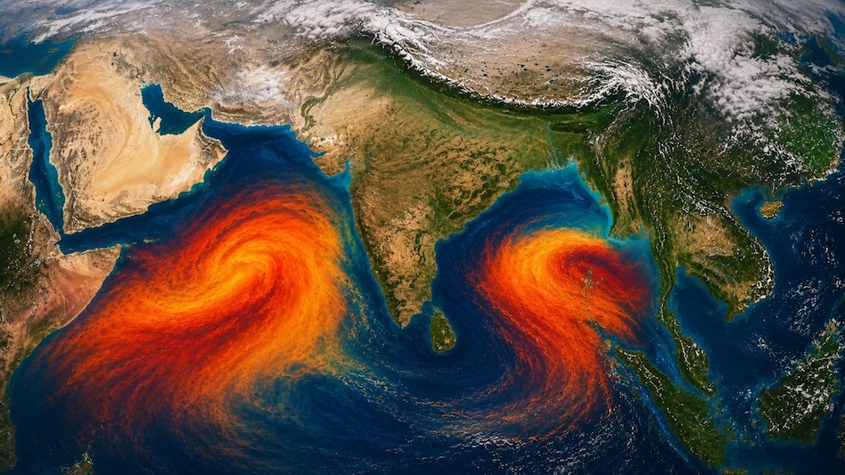

India's southwest monsoon is retreating, but the withdrawal does not mean rainfall stops across the country overnight.
As of October 4, 2026, the India Meteorological Department said the withdrawal line continued through Supaul, Ranchi, Raipur, Brahmapuri, Parbhani, Baramati and Harnai before extending into the Arabian Sea. IMD expected conditions to become favourable during the following two to three days for further withdrawal from most of Marathwada and Vidarbha, additional parts of Maharashtra and Chhattisgarh, and parts of Telangana and north interior Karnataka.
At the same time, rain was still being observed or forecast across eastern, northeastern and southern India.
The apparent contradiction is explained by what "monsoon withdrawal" actually means. It describes a change in the large-scale seasonal circulation, moisture pattern and persistence of rainfall over a region. It is not a declaration that no further rain can occur there.
During the transition into October, residual tropical moisture, troughs, cyclonic circulations and changing low-level winds can continue to generate showers and thunderstorms even while the southwest monsoon steadily retreats.
The 2026 Withdrawal Began on September 19
The southwest monsoon began withdrawing from western Rajasthan on September 19, 2026, two days later than its normal commencement date of September 17, according to IMD's end-of-season assessment.
The withdrawal then progressed across much of northwest and western India through the second half of September and early October.
By October 4, its boundary had moved well into central and western India, but substantial parts of eastern, northeastern and peninsular India remained on the monsoon side of the withdrawal line.
The 2026 southwest monsoon season itself ended with 759.4 mm of all-India rainfall between June and September, equivalent to 87% of the long-period average.
Northwest India received 94% of its LPA and central India 97%, while the south peninsula received 76% and east and northeast India 74%.
Those seasonal totals describe rainfall during June to September. They do not imply that rainfall must stop on October 1.
What Monsoon Withdrawal Actually Means
IMD uses several atmospheric conditions before declaring the initial withdrawal of the southwest monsoon.
For the first withdrawal from western parts of northwest India, the agency considers:
- cessation of rainfall over the area for five continuous days;
- establishment of an anticyclonic circulation in the lower troposphere, at about 850 hPa and below;
- and a substantial reduction in atmospheric moisture.
Further withdrawal is declared when dry conditions and reduced moisture persist while the withdrawal boundary advances in a spatially consistent manner.
For the final withdrawal from southern India, IMD also looks for the broader circulation to change away from the southwesterly wind regime.
These criteria explain why the process takes weeks.
The monsoon does not retreat at the same speed across every state, and the atmospheric circulation over eastern or southern India can remain favourable for rainfall well after northwest India has entered a much drier regime.
Withdrawal Does Not Mean a Permanent End to Rain
A region can receive rainfall after the southwest monsoon has officially withdrawn.
That is because rainfall can be generated by weather systems that are separate from the seasonal monsoon circulation.
A trough, upper-air cyclonic circulation or another low-pressure feature can lift humid air and generate clouds, thunderstorms and locally heavy rain even after the monsoon's dominant southwesterly flow has weakened.
The October 4 IMD analysis showed several such features operating simultaneously.
An upper-air cyclonic circulation was present over Sikkim and nearby areas.
A trough extended from northeast Bihar to the northwest Bay of Bengal through Jharkhand and Gangetic West Bengal, while another extended from south Bihar toward Vidarbha across eastern Madhya Pradesh.
Further south, a cyclonic circulation was positioned over the Gulf of Mannar and adjoining south coastal Tamil Nadu, with a trough stretching across north interior Tamil Nadu and north Kerala toward the east-central Arabian Sea.
These systems provide mechanisms for air to rise and moisture to converge, allowing rain to continue during the withdrawal phase.
Rain Was Still Widespread in Parts of India on October 4
IMD's observations for the 24 hours ending at 8:30 a.m. IST on October 4 showed rainfall at many places over:
- Arunachal Pradesh;
- Sub-Himalayan West Bengal and Sikkim;
- coastal Karnataka;
- and Lakshadweep.
Rain occurred at a few locations across Assam and Meghalaya, Nagaland, Manipur, Mizoram and Tripura, and Kerala and Mahe.
Isolated rainfall was also reported over parts of Bihar, Odisha, Gangetic West Bengal, Konkan and Goa, coastal Andhra Pradesh, Telangana, Rayalaseema, Tamil Nadu and south interior Karnataka.
Sub-Himalayan West Bengal and Sikkim recorded some of the strongest rainfall.
Tra Nagrakata in Jalpaiguri district recorded 19 cm, while Bhagatpur Tea Estate and Nagarkata recorded 18 cm each during the observation period.
IMD classified rainfall at isolated locations in the region as heavy to very heavy. Heavy rain was also recorded at isolated locations in Arunachal Pradesh and Assam and Meghalaya.
These are observed rainfall figures, not forecasts.
Southern India Remains Active During the Transition
Southern India is particularly important during October because it sits near the transition between the retreating southwest monsoon and the atmospheric changes that eventually establish the northeast monsoon.
For October 4 to 10, IMD forecast isolated to scattered rain across coastal Andhra Pradesh, Rayalaseema, interior Karnataka and Tamil Nadu, with rainfall also expected over Kerala, coastal Karnataka and Lakshadweep during parts of the period.
For October 4 to 6, isolated heavy rainfall was forecast over coastal Karnataka, Kerala and Mahe, and Tamil Nadu, Puducherry and Karaikal.
Thunderstorms, lightning and gusty winds were also forecast across several southern subdivisions.
That rainfall should not automatically be labelled northeast-monsoon rainfall simply because it occurs in October.
The atmospheric regime has to complete a more specific transition first.
Post-Monsoon Season and Northeast Monsoon Are Not the Same Thing
October marks the beginning of India's post-monsoon statistical season, which IMD defines as October through December.
That is a climatological reporting period.
The northeast monsoon, by contrast, describes a specific circulation and rainfall regime affecting southern peninsular India, particularly Tamil Nadu, Puducherry, coastal Andhra Pradesh, Rayalaseema, Kerala and south interior Karnataka.
IMD's operational criteria consider the withdrawal of the southwest monsoon, development of persistent easterly winds over the southeast peninsula and sufficiently widespread rainfall before declaring northeast-monsoon onset.
The normal onset over coastal Tamil Nadu and adjoining southern areas is around the second half of October.
That means rain during early October can belong to the transition period rather than representing a fully established northeast monsoon.
Why Changing Wind Direction Matters
During the southwest monsoon, large-scale winds transport moisture toward India primarily from the Arabian Sea and Bay of Bengal under the seasonal southwesterly circulation.
As autumn progresses, continental pressure patterns change and the southwest flow weakens.
Low-level winds eventually turn increasingly easterly or northeasterly across southeastern India.
That reversal is central to the shift toward the northeast monsoon.
But the change is not instantaneous.
Different atmospheric levels can change at different times, and transient weather systems can temporarily alter local wind directions.
This creates a transitional period when remnants of southwest-monsoon moisture coexist with emerging post-monsoon circulation.
The result can be highly variable weather across relatively short distances.
Moisture Can Remain Even as the Monsoon Retreats
Atmospheric moisture does not disappear immediately when the official withdrawal line passes.
Warm seas surrounding the Indian peninsula continue supplying water vapour to the lower atmosphere.
When a trough or cyclonic circulation develops, that moisture can converge and rise.
If the air is sufficiently unstable, thunderstorms can develop.
This is why withdrawal criteria include both a reduction in moisture and sustained dry weather rather than relying on the calendar alone.
It is also why a brief rain event after withdrawal does not necessarily mean the monsoon has "returned."
The dominant seasonal circulation may still have shifted even though another weather system produces temporary precipitation.
Thunderstorms Become Important During the Transition
Thunderstorms can become prominent during transition periods because warm, humid low-level air can interact with changing wind patterns and atmospheric disturbances.
For October 4 onward, IMD forecast thunderstorms and lightning across parts of the northeast, east and south.
Tamil Nadu, Kerala and Lakshadweep were among the areas where gusty winds of 40 to 50 km/h, gusting to around 60 km/h, were forecast during parts of October 4 to 8.
Lower but still notable gust speeds were forecast over coastal Andhra Pradesh, Rayalaseema, Telangana and several other regions.
These forecasts describe expected short-term weather conditions and are separate from IMD's official monsoon-withdrawal declaration.
Northern India Can Also See Rain After Withdrawal
The withdrawal of the southwest monsoon from northern India does not mean the region will remain dry for the rest of autumn.
IMD's October 4 forecast called for isolated to scattered rainfall over Himachal Pradesh and Uttarakhand during several days between October 5 and 10.
Rain was also forecast over parts of Punjab, Haryana, Delhi and Uttar Pradesh later in the period, with thunderstorms and gusty winds possible in some areas.
Such rainfall occurring after monsoon withdrawal demonstrates the difference between monsoon rainfall and rainfall that happens after the monsoon.
Withdrawal describes the dominant seasonal circulation, not a prohibition on future weather systems.
More Withdrawal Is Expected in the Coming Days
IMD said on October 4 that conditions were likely to become favourable during the next two to three days for southwest-monsoon withdrawal from:
most of Marathwada and Vidarbha, additional parts of Maharashtra and Chhattisgarh, and portions of Telangana and north interior Karnataka.
That is a forecast rather than an accomplished withdrawal.
IMD will only move the official withdrawal line after the required atmospheric and rainfall conditions are observed.
This distinction is important because monsoon withdrawal is operationally diagnosed rather than declared simply because a forecast suggests dry weather is coming.
October Is Expected to Be Drier Than Normal Nationally
The persistence of rain in some regions also does not mean October as a whole is expected to be unusually wet across India.
IMD's September 30 seasonal outlook said all-India rainfall during October 2026 is most likely to be below normal, at less than 85% of its long-period average.
The country's October LPA is approximately 75.4 mm.
IMD expects most of India to receive below-normal rainfall during the month, while parts of northwest India, the southern peninsula and isolated areas of eastern India may receive normal to above-normal rainfall.
That is a monthly probabilistic forecast.
It does not rule out individual episodes of heavy rain or thunderstorms within an otherwise drier-than-normal month.
Southern India Enters Its Important Rainfall Season
For southern peninsular India, the October-to-December period has a very different climatological significance.
IMD says the five southern subdivisions used in its northeast-monsoon assessment receive about 30% of their annual rainfall during October to December.
Tamil Nadu, Puducherry and Karaikal receive approximately 48% of their annual rainfall during this period.
For the 2026 post-monsoon season, IMD currently expects rainfall across south peninsular India to be in the normal range of 88% to 112% of its long-period average.
The LPA for those five subdivisions combined during October to December is around 334.1 mm.
Again, that is a seasonal forecast rather than rainfall already observed.
Conclusion
The continued rain and thunderstorms during India's 2026 monsoon withdrawal are not evidence that the withdrawal has stopped or failed.
They are part of a normal atmospheric transition in which different parts of the country move out of the southwest-monsoon circulation at different times.
As of October 4, the monsoon had withdrawn from much of northwest and western India, while its withdrawal boundary still ran through parts of Bihar, Jharkhand, Chhattisgarh and Maharashtra toward the Arabian Sea.
At the same time, IMD was monitoring troughs and cyclonic circulations over eastern and southern India that were supporting continued rainfall and thunderstorm activity.
The key distinction is that monsoon withdrawal is a change in the dominant seasonal circulation, not an immediate end to all rainfall.
Moisture can remain, local and regional disturbances can still develop, and new weather systems can bring rain even to areas where the southwest monsoon has already withdrawn.
October therefore acts as a bridge between weather regimes: the southwest monsoon continues its retreat, the official post-monsoon season begins, and southern India gradually approaches the conditions required for the northeast monsoon.
That transitional overlap is why clear skies in one part of India can occur at the same time as heavy rain and thunderstorms in another.
Nexuswild welcomes factual corrections. Email contact@nexuswild.com with evidence and the article URL.