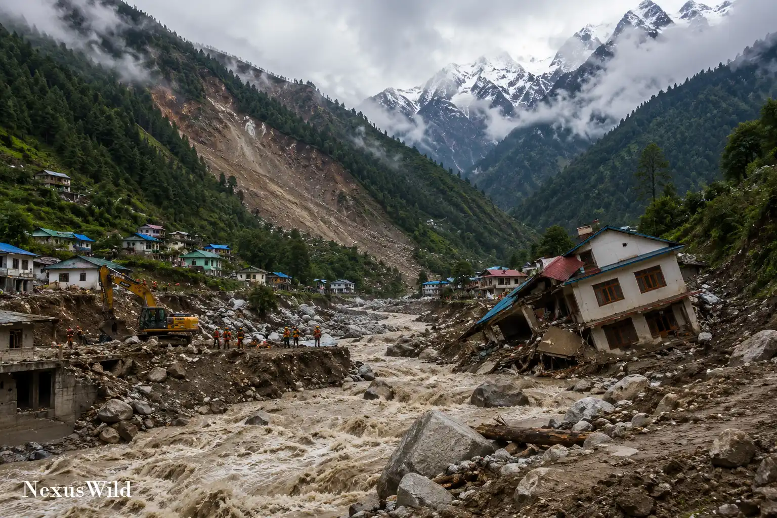

A catastrophic flood along the Nepal-Tibet border has become the latest in a series of deadly Himalayan disasters involving collapsing slopes, unstable glaciers, extreme rainfall and vulnerable river valleys.
The August 26, 2026 disaster killed at least 98 people, according to the latest figures available at the time of writing. Nepal Police reported recovering 95 bodies, while Chinese authorities confirmed three deaths in Tibet. The figures were substantially higher than the initial toll cited in an earlier Reuters review of Himalayan disasters.
Hundreds remained unaccounted for. Nepal’s Tourism Ministry listed at least 341 foreign travellers as missing, alongside an unspecified number of local residents. Chinese authorities separately reported 265 people missing in Tibet. Because the lists were still being revised and may contain overlapping records, they should not be combined into a single total.
Glacier Collapse Suspected in Nepal-Tibet Flood
The flood swept through Nepal’s Rasuwa district and Tibet’s Gyirong County, damaging settlements near Timure and Syapru Besi, the Gyirong border port, roads, bridges, communications infrastructure and hydropower facilities. Broken access routes and high river levels complicated helicopter operations and ground searches.
Satellite imagery examined by scientists indicated that the lower section of a glacier at an elevation of about 5,200 metres broke away and fell roughly 1,200 metres into the valley. The collapse appears to have produced an ice-rock avalanche that sent water, sediment and boulders through the Lhende, Bhote Koshi and Trishuli river systems, Reuters reported.
The precise trigger has not been established. Germany’s GFZ geoscience centre detected a magnitude 4.4 earthquake shortly before the flood was recorded on security cameras. Scientists are investigating whether the tremor destabilised the glacier, but a causal connection has not been confirmed. Recent warmth and snow loss may also have contributed to instability, although researchers lacked local weather-station evidence sufficient to reach a conclusion.
Authorities warned that debris could have created an upstream blockage capable of releasing another surge. Communities downstream were placed on alert while Nepali and Chinese teams continued rescue, recovery and damage-assessment operations.
Floods in Uttarakhand and Nepal
In August 2025, a fast-moving debris flow struck Dharali in Uttarkashi district in the Indian state of Uttarakhand. Four deaths were officially confirmed and 52 people remained listed as missing in subsequent scientific reporting.
The flow buried buildings, damaged roads and disrupted the route to the Gangotri pilgrimage site. Although early accounts described a possible cloudburst, later analysis by Indian geoscientists attributed the disaster to the collapse of water-saturated glacial and moraine material near the Shrikanth Glacier. Persistent rain and thawing may have weakened the slope, but the event was not established as a conventional glacial lake outburst flood.
Nepal suffered another major disaster on September 27 and 28, 2024, when extreme monsoon rainfall triggered floods and landslides across Kathmandu Valley and numerous surrounding districts. A government-led assessment recorded 249 deaths, 18 missing people and 177 injuries as of October 9.
Thousands of homes were destroyed or damaged. Roads, bridges, schools, health facilities and hydropower infrastructure were also affected. The event demonstrated how exceptional rainfall can quickly overwhelm settlements built on floodplains and unstable slopes.
Sikkim’s Glacial Lake Outburst
On October 3, 2023, part of the moraine beside South Lhonak Lake in India’s Sikkim state collapsed into the water. The resulting displacement wave breached the lake’s natural barrier and released a glacial lake outburst flood down the Teesta Valley.
Indian authorities ultimately treated 79 people who remained missing as dead, taking the toll to 179, Reuters reported. The flood destroyed or damaged homes, bridges, roads and military facilities. It also overwhelmed the Teesta III hydropower dam at Chungthang.
A later peer-reviewed reconstruction published in Science found that approximately 14.7 million cubic metres of frozen moraine material fell into the lake, generating a wave about 20 metres high. Glacier retreat and thawing permafrost had helped create the unstable setting, but the slope collapse was the immediate trigger.
Joshimath and the Silkyara Tunnel
Not every Himalayan emergency during this period began with a sudden flood.
In January 2023, nearly 200 people were evacuated from Joshimath, Uttarakhand, after land subsidence opened cracks in hundreds of buildings, roads and other structures. The town stands on old landslide deposits, making its foundations naturally vulnerable. Researchers and government specialists have also examined inadequate drainage, groundwater movement, heavy construction and pressure from tourism and infrastructure development. No single cause explains the crisis.
Later that year, on November 12, part of the Silkyara Bend-Barkot road tunnel in Uttarkashi collapsed during construction, trapping 41 workers. All were rescued on November 28 after 17 days underground. Authorities had not established a definitive cause when the rescue ended. The incident nevertheless highlighted the technical and safety challenges of major construction in fractured Himalayan rock.
The 2021 Chamoli Avalanche
One of the clearest examples of a cascading Himalayan disaster occurred in Chamoli district on February 7, 2021.
About 27 million cubic metres of rock and glacier ice detached from Ronti Peak, according to a peer-reviewed investigation summarised by the US Geological Survey. The material fell into the Ronti Gad valley and transformed into a high-speed debris flow.
Official accounting placed the number killed or missing at 204. The flow destroyed the Rishiganga hydropower project and severely damaged the Tapovan Vishnugad project, where many victims were working. Bridges and roads were also swept away.
The study found no evidence that a glacial lake had burst. Instead, the event began as a massive rock-ice avalanche, showing how one type of slope failure can rapidly evolve into a destructive river-valley flood.
Kashmir and the Legacy of Kedarnath
In September 2014, exceptionally heavy rain caused the Jhelum and other rivers to overflow across Kashmir. Official figures cited by Reuters recorded about 200 deaths on the Indian-administered side and 264 in Pakistan-administered territory. Srinagar and numerous towns and villages were inundated, while roads, power supplies and communications failed.
The broader period is often viewed against the June 2013 Uttarakhand disaster, just beyond a strict 12-year timeline. Intense monsoon rain caused floods and landslides around Kedarnath and elsewhere in the state. Authorities initially confirmed 580 deaths and listed 5,748 people as missing, many of whom were later presumed dead for compensation purposes. Roads, bridges, buildings and pilgrimage infrastructure were destroyed, leaving tens of thousands stranded.
Why Himalayan Hazards Become Disasters
The Himalayas combine several natural hazards in one of the world’s steepest and most tectonically active landscapes. The continuing collision of the Indian and Eurasian plates produces earthquakes and leaves extensive areas of fractured rock. Steep slopes, deep river valleys and powerful monsoon systems create favourable conditions for landslides and flash floods.
Warming adds longer-term risks. Glaciers are retreating, many glacial lakes are expanding, and thawing ice or permafrost can weaken high mountain slopes. Extreme rainfall can mobilise loose sediment or trigger failures already made unstable by geology and erosion. Avalanches can also block rivers temporarily, creating lakes that may later drain suddenly.
These trends do not establish climate change as the immediate cause of every disaster. Earthquakes, local rainfall, slope geometry, erosion and structural weaknesses may determine when a particular failure occurs. In several cases, including the 2026 Nepal-Tibet flood, the exact combination of triggers remains under investigation.
Development Increases Exposure
Roads, hydropower plants, hotels, pilgrimage facilities and expanding towns are frequently concentrated in narrow Himalayan valleys because those corridors offer access, water and relatively buildable land. The same valleys carry floods, debris and landslide material.
Research has linked poorly engineered road cuts, inadequate drainage, spoil dumping and slope excavation with increased local landslide risk. Hydropower projects can place workers and valuable infrastructure directly in channels exposed to avalanches and outburst floods. Tourism and urban growth can increase the number of people present while straining drainage, emergency access and building oversight.
Development does not cause every avalanche, earthquake or episode of extreme rainfall. It can, however, turn a remote natural event into a mass-casualty disaster by increasing exposure or disturbing already unstable terrain.
The latest Nepal-Tibet flood reinforces the need for cross-border warning systems, glacier and slope monitoring, hazard-informed construction and evacuation planning. It also shows why early explanations must remain provisional. In the Himalayas, disasters often result not from one cause but from a chain of geological, climatic and human factors.
Further reading and useful links
Reader questions
Frequently asked questions
How many people died in the August 2026 Nepal-Tibet flood?
At least 98 people were killed (95 in Nepal and 3 in Tibet), and hundreds more remain missing, including foreign travelers and local residents.
What caused the recent Nepal-Tibet flood?
Scientists suspect an ice-rock avalanche was triggered when the lower section of a glacier collapsed into the valley. While the exact trigger is unconfirmed, a magnitude 4.4 earthquake was detected nearby shortly before the event.
Why is the Himalayan region so vulnerable to natural disasters?
The Himalayas feature steep, tectonically active slopes and deep river valleys. This is exacerbated by extreme monsoon rains, retreating glaciers due to warming, and infrastructure development concentrated in vulnerable corridors.
Nexuswild welcomes factual corrections. Email contact@nexuswild.com with evidence and the article URL.