Last updated: Tuesday, August 18, 2026, based on the latest figures released by Indonesia's National Disaster Management Agency (BNPB).
A powerful 7.7-magnitude earthquake that struck off the coast of Indonesia's Flores island on Saturday has killed at least 70 people, with more than 1,180 injured and over 40,000 displaced, according to the latest update from the National Disaster Management Agency (BNPB). Four days on, thousands of residents remain without adequate shelter, food, clean water or medicine, as rescue and relief teams continue working through landslide-damaged roads to reach the worst-affected communities.
When and Where the Earthquake Struck
The earthquake hit at around 5:58 a.m. local time on Saturday, August 15, 2026, with its epicentre roughly 68 kilometres (42 miles) north-northwest of the coastal city of Ende, in East Nusa Tenggara province. The quake was centred in waters off the northern coast of Flores island, part of the Lesser Sunda chain in eastern Indonesia, hundreds of kilometres east of Bali. Indonesia's Meteorology, Climatology and Geophysics Agency, BMKG, identified the Flores Back-Arc Thrust as the source of the rupture, the same general fault system responsible for a devastating earthquake and tsunami on Flores in December 1992.
Magnitude, Depth and Affected Areas
The United States Geological Survey (USGS) measured the quake at magnitude 7.7, with a depth of about 10 kilometres (6.2 miles), classifying it as a shallow and therefore more damaging rupture. The USGS estimated that roughly two million people were exposed to strong or violent shaking. The worst-hit areas span six regencies across Flores and its surrounding islands: Manggarai, East Manggarai, Nagekeo, Sikka, Ende, West Manggarai and Ngada, with Manggarai and East Manggarai recording the highest number of deaths.
Latest Confirmed Death and Injury Toll
BNPB's death toll has climbed steadily since the quake struck, rising from an initial count in the high 30s on Saturday, to 47 later that day, to 68 by Monday, and to 70 as of Tuesday's briefing. The agency has said it will continue to update the figures as verification work continues in affected villages. As of the latest count, 1,182 people have been injured. Indonesia's national search and rescue agency, Basarnas, said on Tuesday that no one remains reported missing, as teams have completed sweeps of the affected areas.
Displaced People and Damaged Homes
More than 40,000 people have been displaced across the affected regencies, official figures show, with the largest numbers reported in East Manggarai and Manggarai. Damage assessments have found close to 19,300 homes affected in total, including over 6,400 severely damaged, roughly 2,500 moderately damaged, and around 12,000 with lighter damage. Schools, health facilities, places of worship and government buildings were also damaged, and terminal buildings, though not runways, were affected at five airports in the region, according to Indonesia's Transport Ministry.
Aftershocks and the Tsunami Warning
BMKG issued a tsunami warning immediately after the main quake, covering East Nusa Tenggara, West Nusa Tenggara, South Sulawesi and Southeast Sulawesi provinces, and urged coastal residents to move away from beaches and riverbanks to higher ground. The warning was lifted later the same day after no significant wave was recorded.
Aftershock activity has been extensive. More than 230 aftershocks were recorded on the first day alone, including one of magnitude 6.2. By Tuesday, BNPB reported a cumulative total of 2,119 aftershocks since Saturday, ranging from magnitude 1.3 to 6.2, of which about 70 were strong enough to be felt by residents. Officials have said seismic activity in the region is expected to gradually taper off over the next two to three weeks.
Thousands Still Waiting for Aid
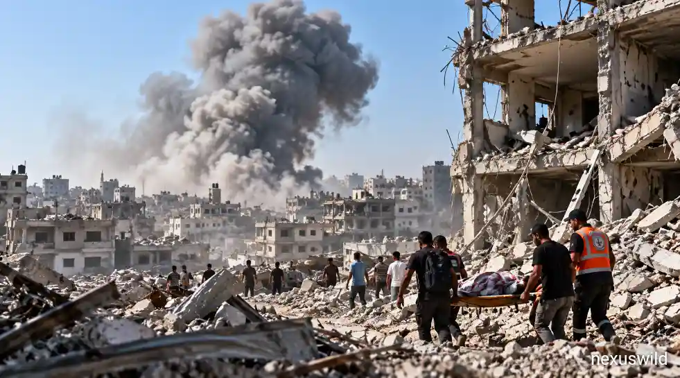
Days after the quake, large numbers of residents remain without basic supplies. Many families in Sikka regency, one of the hardest-hit areas, have been sheltering in a sports arena after fleeing damaged or destroyed homes. Across the island, people have been sleeping outside collapsed or cracked houses under tarpaulin tents, wary of entering structurally unsound buildings because of continuing aftershocks. Aid organisations and government agencies have reported shortages of food, clean water and medicine at several displacement sites, even as relief supplies continue to arrive.
Landslides, Blocked Roads and Rescue Challenges
Landslides triggered by the earthquake blocked multiple roads, particularly cutting off access to Nagekeo regency in the immediate aftermath and delaying rescue teams reaching some of the worst-affected villages. Fallen trees and large boulders dislodged by slope failures blocked routes in mountainous parts of the island, and communication signals were disrupted in some areas, further complicating early relief efforts. Aerial images taken days after the quake showed deep cracks splitting roads in Nagekeo. By Monday, rescue teams had reached the last of the landslide-isolated communities.
Government and Emergency Response
President Prabowo Subianto directed government agencies to respond swiftly, and used Indonesia's Independence Day observance on Monday, August 17, to lead a nationwide moment of silence for those affected by the disaster in East Nusa Tenggara and elsewhere in the country. The Indonesian military deployed more than 1,200 personnel to support search, rescue and relief operations in the affected regencies. The governor of East Nusa Tenggara declared a 14-day emergency response period for the province. State energy company Pertamina restored fuel and LPG supplies to Flores by August 16, and BNPB reported that broader infrastructure in the province was gradually being restored through the following days.
Conditions in the Worst-Hit Communities
In towns such as Maumere, Borong and Ruteng, residents have described widespread structural damage, with buildings collapsed onto parked vehicles and public facilities, including a port terminal waiting room in Maumere, destroyed. Indonesia's health ministry reported damage to a hospital in Maumere, and medical staff at Ruteng's regional hospital have been treating patients in temporary outdoor tents because of concerns that aftershocks could further damage hospital buildings. At displacement shelters such as one in Maumere, aid workers have also organised trauma-support activities for children affected by the disaster.
Current Rescue, Medical and Relief Efforts
With search operations for missing persons now complete, according to Basarnas, the focus has shifted toward medical treatment, debris clearance and the delivery of humanitarian aid to displacement sites. Emergency medical tents have been set up in several locations to treat both earthquake injuries and manage the risk of disease outbreaks in crowded shelters. Indonesia's government has said it will continue directing relief supplies, including food, water, medicine and temporary shelter materials, to the affected regencies as needs are assessed.
Why Indonesia Is Highly Vulnerable to Earthquakes
Indonesia sits along the Pacific Ring of Fire, a horseshoe-shaped belt of fault lines and volcanoes where several tectonic plates meet and grind against one another, making the archipelago one of the most seismically active regions on Earth. Flores itself has a documented history of major, damaging earthquakes: a magnitude 7.7-7.8 quake and tsunami in December 1992 killed an estimated 2,000 to 2,500 people on the island, and the region has experienced other significant ruptures in the decades since, including a 2018 sequence centred near Lombok. More broadly, Indonesia's seismic risk was underscored on a much larger scale by the magnitude 9.1 earthquake and tsunami off Sumatra in December 2004, which killed more than 170,000 people in the country alone. Saturday's quake is being described as Indonesia's deadliest since a 2022 earthquake in West Java.
What Authorities Are Warning Residents About Now
BNPB has said seismic activity in the region remains unsettled and is likely to continue for another two to three weeks before stabilising, and has urged residents to stay away from cracked or structurally damaged buildings because of the continued risk of aftershocks. While the initial tsunami warning was lifted on the day of the earthquake, officials have asked coastal communities to remain alert and to follow official updates from BMKG and BNPB rather than unverified reports, particularly given the possibility of further aftershocks in the coming weeks.
Further reading and useful links
Reader questions
Frequently asked questions
What is the latest confirmed death toll from the Indonesia earthquake?
As of Indonesia's National Disaster Management Agency's update on Tuesday, August 18, 2026, at least 70 people have died and 1,182 have been injured. Basarnas has confirmed that no one remains reported missing.
Where exactly did the earthquake strike?
The magnitude 7.7 quake struck off the northern coast of Flores island in East Nusa Tenggara province, with its epicentre about 68 km north-northwest of the city of Ende, at a depth of roughly 10 km.
Was a tsunami warning issued?
Yes. BMKG issued a tsunami warning for parts of East Nusa Tenggara, West Nusa Tenggara, South Sulawesi and Southeast Sulawesi shortly after the quake. It was lifted later the same day after no significant wave was recorded.
How many people have been displaced or lost their homes?
More than 40,000 people have been displaced, and close to 19,300 homes have been damaged across the affected regencies, according to official figures.
Nexuswild welcomes factual corrections. Email contact@nexuswild.com with evidence and the article URL.