
Executive Summary
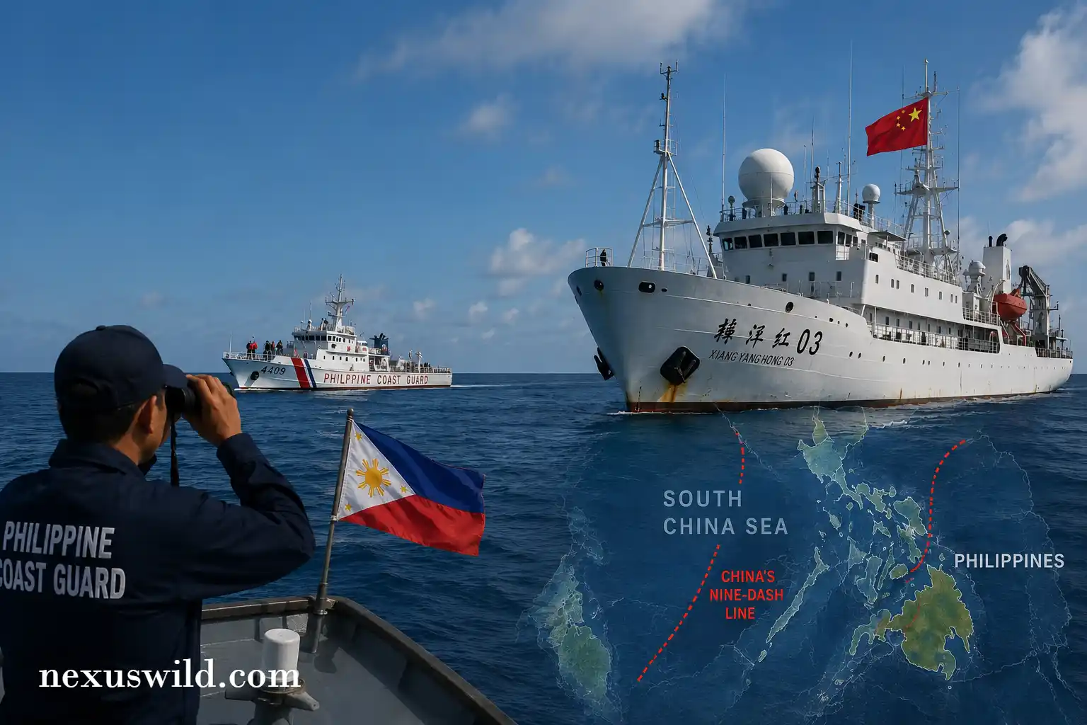
- EEZ Violation: The Philippine government has formally protested the unauthorized presence of advanced Chinese marine research vessels operating deep within its 200-nautical-mile Exclusive Economic Zone (EEZ).
- Dual-Use Data Collection: Security analysts warn that seabed mapping and oceanographic data collection have significant military applications, specifically for submarine warfare and anti-access/area denial (A2/AD) strategies.
- Economic Risk Factor: Persistent maritime instability in the South China Sea threatens critical global shipping lanes, forcing international investors and logistics firms to reassess regional supply chain security.
- International Response: The incident has drawn swift condemnation from allied nations, prompting calls for increased joint patrols to uphold the United Nations Convention on the Law of the Sea (UNCLOS).
The geopolitical fault lines of the Indo-Pacific have fractured further as the Philippine government formally accuses China of conducting illegal marine scientific research within its sovereign maritime territory. The confrontation, occurring in early March 2026, represents a calculated shift in the ongoing South China Sea dispute. While previous conflicts primarily centered around territorial fishing rights and the resupply of military outposts, the unauthorized deployment of highly sophisticated oceanographic survey vessels points toward a much deeper strategic objective.
For global investors and security strategists monitoring the region, the distinction between civilian research and military intelligence gathering is increasingly blurred. The data harvested from these surveys is critical not only for resource extraction but for the operational dominance of the maritime domain.
The Incident at Sea
According to verified reports from the Philippine Coast Guard, an advanced Chinese research vessel, flanked by maritime militia escorts, was tracked operating for an extended period near the resource-rich Reed Bank. The area falls squarely within the internationally recognized Exclusive Economic Zone of the Philippines. Despite repeated radio challenges and diplomatic protests issued by Manila, the vessels continued their operations, deploying deep-water submersibles and sonar arrays.
Under the framework of UNCLOS, a coastal state holds exclusive jurisdiction over marine scientific research within its EEZ. Any foreign entity wishing to conduct such operations must obtain explicit prior consent. The Philippine Department of Foreign Affairs has confirmed that no such authorization was requested or granted.
"We are witnessing a systematic effort to map the underwater topography of the West Philippine Sea. The implications are clear: this data is dual-use, highly sensitive, and fundamentally alters the security calculus of the entire region."
- Regional Security Analyst, Manila Institute for Defense Studies
The Strategic Value of Seabed Mapping
The accusations of illegal research highlight a critical, often overlooked dimension of naval strategy. While surface skirmishes dominate the headlines, the true contest for the South China Sea is increasingly taking place below the surface. Oceanographic surveys gather vital intelligence on water temperature, salinity, ocean currents, and acoustic propagation.
This data is the lifeblood of modern submarine warfare. Detailed knowledge of the underwater environment allows a navy to hide its own submarines effectively while improving its ability to detect adversarial assets. By mapping the contours of the Philippine EEZ, China is systematically degrading the tactical advantage of opposing naval forces that may operate in the area during a potential conflict.
| Research Activity | Stated Civilian Purpose | Potential Military Application |
|---|---|---|
| Bathymetric Surveying | Navigational safety, geological mapping. | Submarine navigation, bottom-crawling autonomous vehicle routing. |
| Hydrological Data Collection | Climate research, marine biology. | Optimizing sonar performance, calculating thermal layers for submarine evasion. |
| Seismic Profiling | Oil and natural gas exploration. | Identifying optimal locations for underwater acoustic sensor networks. |
Economic Impact and Investor Sentiment
The continuous testing of maritime boundaries carries profound economic consequences. Over one-third of global maritime trade transits through the South China Sea. The persistent friction between Manila and Beijing, compounded by the presence of research vessels mapping potential energy reserves, introduces a severe risk premium to the region.
For international energy corporations, the disputed nature of these waters makes joint exploration ventures highly precarious. The unauthorized surveys effectively signal a claim over future resource extraction, deterring foreign direct investment in the Philippine energy sector. Furthermore, maritime insurers are closely monitoring the escalation, as any miscalculation involving coast guard vessels or sovereign assets could dramatically impact shipping premiums.
The Path Forward: Upholding UNCLOS
The diplomatic fallout from this latest incident has been swift. Allied nations have reiterated their support for the 2016 Arbitral Award, which invalidated China's expansive territorial claims in the region. To counter the unauthorized presence of foreign survey vessels, the Philippines is accelerating its maritime modernization program, heavily prioritizing the acquisition of advanced coastal radar systems and long-endurance patrol craft.
As 2026 unfolds, the strategic reality is stark. The deployment of research vessels represents a sophisticated gray-zone tactic, designed to assert dominance and gather critical intelligence without triggering a conventional military response. Upholding international law will require more than diplomatic protests; it will necessitate persistent, coordinated presence and unwavering international solidarity.
Nexuswild welcomes factual corrections. Email [email protected] with evidence and the article URL.